GOVERNMENT & SMART CITIES
Our solution SmartGov makes spatial technology available to local governments with simple
modules specially adapted to their needs, from the improvement of public incomes, the
optimization of public services, planning of a human-centric and sustainable urban
development, to environmental and climate change risk management.
IMPACT

Aligned with the United Nations Sustainable Development Goals (SDGs):

Cadastre and Public Revenues
- Integration of satellite data to existing geographic data in the municipality, city or town, and standardization of data loading in the different areas of competence.
- Multi-finality cadastre based on automated protocols converging on a single parcel code.
- Monitoring of irregular settlements and identification of new ones.
- Recurrent generation of cartography for monitoring and control of changes in the territory.
- Updating of tax schemes according to benefits and improvements received in each property.
- Massive land and property valuations.
- Identification of undeclared improvements in parcels.
- Control of compliance with urban planning indicators according to land use regulations.
Urban Development, Public Works and Services
- Monitoring of vegetation condition, including green spaces and urban trees, based on satellite indexes and computer vision with very high resolution images.
- Municipal public works planning, based on satellite images and information from municipal records and national censuses.
- Preventive maintenance of infrastructure (roads, rural and local roads, bridges, etc.), based on the combination of satellite images, derived products and information collected in the field.
- Identification and management of open dumps. Landfill monitoring to know the active sources. Detection of clandestine dumps.
- Control of exclusion zones in installations (pipelines, power lines, solar panels, telecommunication towers, etc.).
Health and Wellness
- Standardization and integration of databases from different thematic sources, at different scales and time periods.
- Association between environmental determinants (access to drinking water, sewage, exposure to toxic pesticides); social determinants (educational level, access to health coverage, activity status, occupational category), demographic structure (male population, female population, proportion of population over 60, over 65, over 70, under 14), housing characteristics and environmental variables.
- Elaboration of thematic cartography based on the calculation of indicators and rates (gross rates, specific rates, morbidity indicators, mortality indicators, behavioral risk factor indicators, health services indicators, environmental health indicators, distribution of equipment).
- Epidemiological monitoring (for environment-related diseases, emerging diseases, zoonotic diseases, epidemics).
- Definition and characterization of vulnerable areas and elaboration of risk maps.
Civil Protection, Risk Management and Emergencies
- Estimation of damages due to disasters (affected area, severity) of different types.
- Hazard analysis and mapping of specific hazards (floods, fires, landslides, etc).
- Vulnerability analysis and preparation of disaster vulnerability maps.
- Support for rapid response to emergencies.
Training and technology adoption
- User training is a particularly critical point in the Government 4.0 paradigm, since it enables the integral and efficient use of new technologies.
- In each SmartGov implementation, a technology and capacity transfer device is foreseen, tailor-made for each project.
- This can take the form of courses or seminars that can be delivered in face-to-face and/or in virtual modes, with a specific consulting module for solving real problems selected by the users.

Análisis del verdor relativo por cuadra y del estado y salud del arbolado urbano por medio del análisis de curvas de NDVI

Análisis satelital sobre el Parque Industrial Almirante Brown. Detección del nivel de actividad mediante información de emisividad térmica.
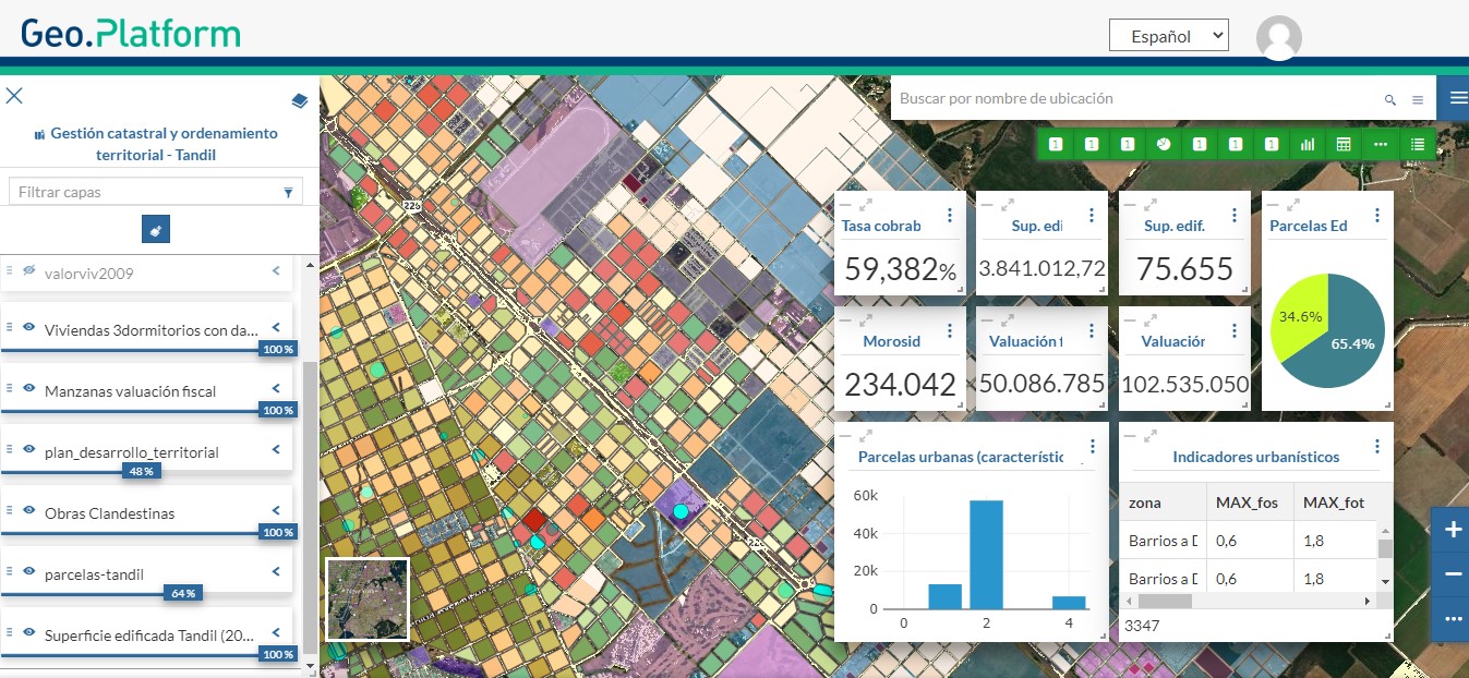
Catrastro multifinalitario
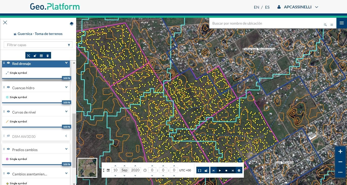
Control de cambios para nuevos asentamientos
