EARLY WARNING & EMERGENCY RESPONSE
Our geospatial solutions bring the best of Earth observation technology to support the full life-cycle risk management of floods, landslides, wildfires, volcanic eruptions, earthquakes, among others, and its impact on people, properties and critical infrastructure like energy plants, dams, bridges and big buildings.
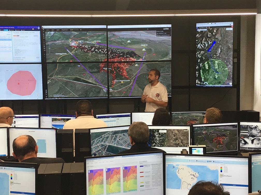
Comprehensive geospatial intelligence center
- Access to secure and source-diversified Earth Observation satellite virtual constellation. Including Multispectral, optical VHR, SAR, RF Detection and Thermal.
- Integration of data from drones, radars, meteorological, databases, GIS, and information from different relevant institutions.
- Advanced tool for developing and managing risk maps in a collaborative and systematic way with provinces, municipalities and other entities.
- Automatic analytical products and area monitoring based on Earth Observation satellites for early warning and emergency management.
- Mobile application for supporting systematic field data collection.
- Flexibility to develop new tools, predictive models and data processors for Early Warning and Automatic Event Triggers.
- Cyber-secure on premises deployment for Warning and Emergency Centers.
Rapid mapping
- On-demand and fast provision of geospatial information in support of emergencies and disasters.
- High priority Earth observation satellite programming.
- Standardized products based on product type and production mode (service levels) the user can choose when requesting the service.
- Service available on a 24×7 basis.
Risk management collaborative tools
- Intuitive collaborative geospatial cloud-based application for elaboration of risk maps by Local Governments, States, Companies and all relevant entities.
- Provides the tools for the generation of risk maps, including access to the needed input data, attribute editing tools, predefined data models, geometric buffering, clipping, clipping, joining, intersection and merging calculations, management of metadata according to ISO 19115 standards.
- Tools and training for risk and vulnerability mapping (wildfire, floods, landslides, etc) / (population, critical infrastructure, etc).
- Tools and training for estimation and mapping of areas affected by natural catastrophes (flooded area mapping, landslided, burnt surface, etc.).
- Tools and training for estimation of damage and losses due to extreme weather events (hail storms, frost, droughts, etc.).

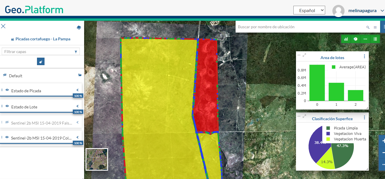
Picadas cortafuego – La Pampa
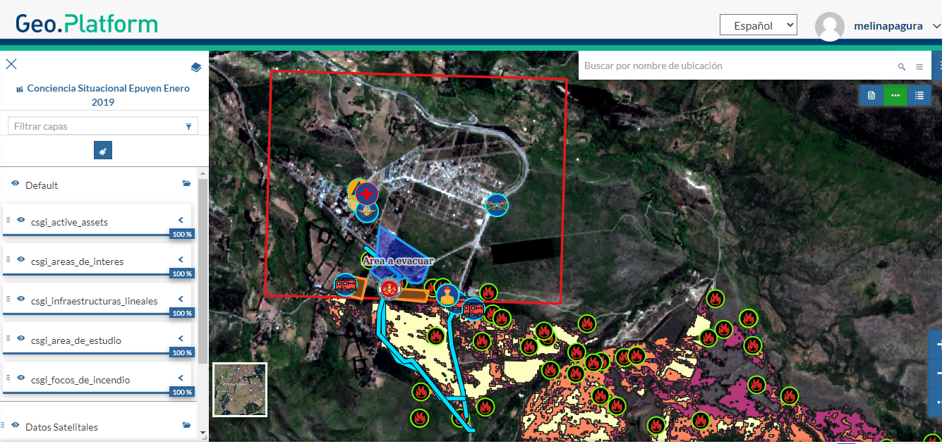
Mapa de conciencia situacional Epuyen 2019
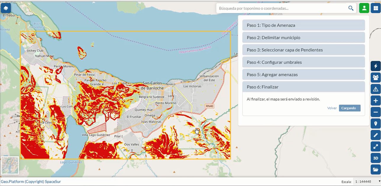
Tools for Risk Maps