INFRASTRUCTURE
Our solutions integrate satellite technology with geospatial systems to support the full infrastructure cycle, from planning to operations, for complex and critical assets including pipelines, buildings, energy plants, power lines, airports and ports, cultural heritage sites, bridges, highways, among others.
Planning and preparation
- Multi temporal retrospective site analysis with satellite data historical archive.
- Environmental baseline determination. Land use. Natural assets measurement (i.e. forests).
- 3D terrain calculation.
- Modeling of natural hazards (i.e. floods) in the area of interest.
Procurement and construction
- Multitemporal engineering works by monitoring change detection and object identification.
- Deformation monitoring of terrain and surrounding properties.
- Monitoring of natural hazards in the area of interest.
Maintenance and operation
- Critical infrastructure and exclusion zone change monitoring.
- Detection and identification of unauthorized objects in the exclusion areas.
- Complex infrastructure deformation rate calculation and anomaly detection.
- Monitoring of natural hazards in the area of interest.
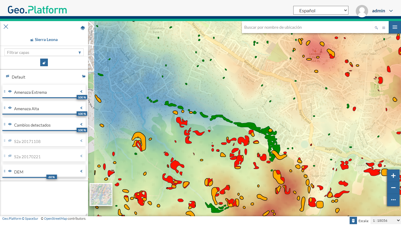
Big City Landslides Monitoring with InSAR
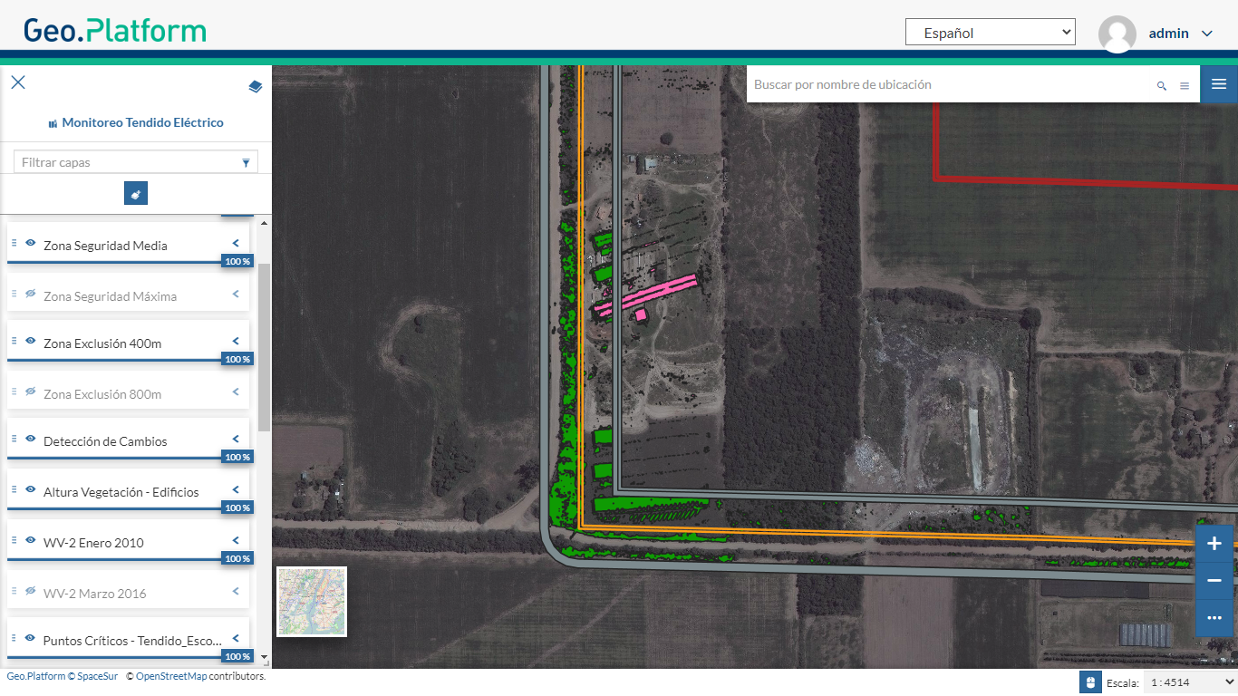
Powerline Safety Monitoring with Satellites
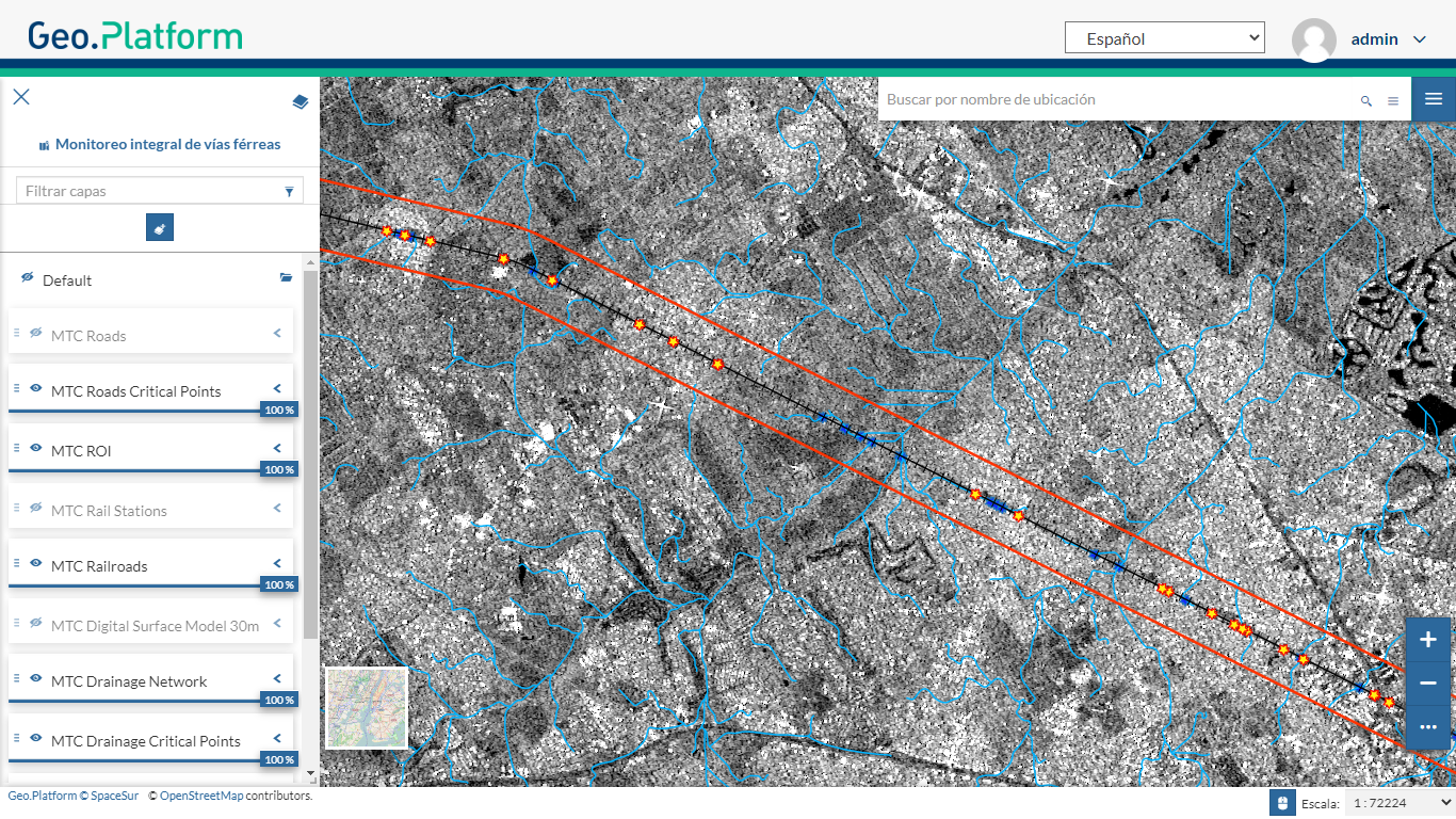
Railway Critical Points Identification and Monitoring
